
The best Mexico road trip detours are the ones you didn’t plan. This guide maps eight Mexico road trip detours that slip off popular routes into quieter country: cloud forests, canyons, cactus gardens, jungle tracks, and high volcanic passes. Each stop is chosen for scenery first, crowds last. You’ll find where to pull over, how to time light and weather, and what small fees to expect as of 2026. No breathless claims—just routes you can actually drive and enjoy. Toss a paper map in the glove box, cue a favorite playlist, and leave some room for tamales in the trunk.
1. Sunrise above a sea of clouds
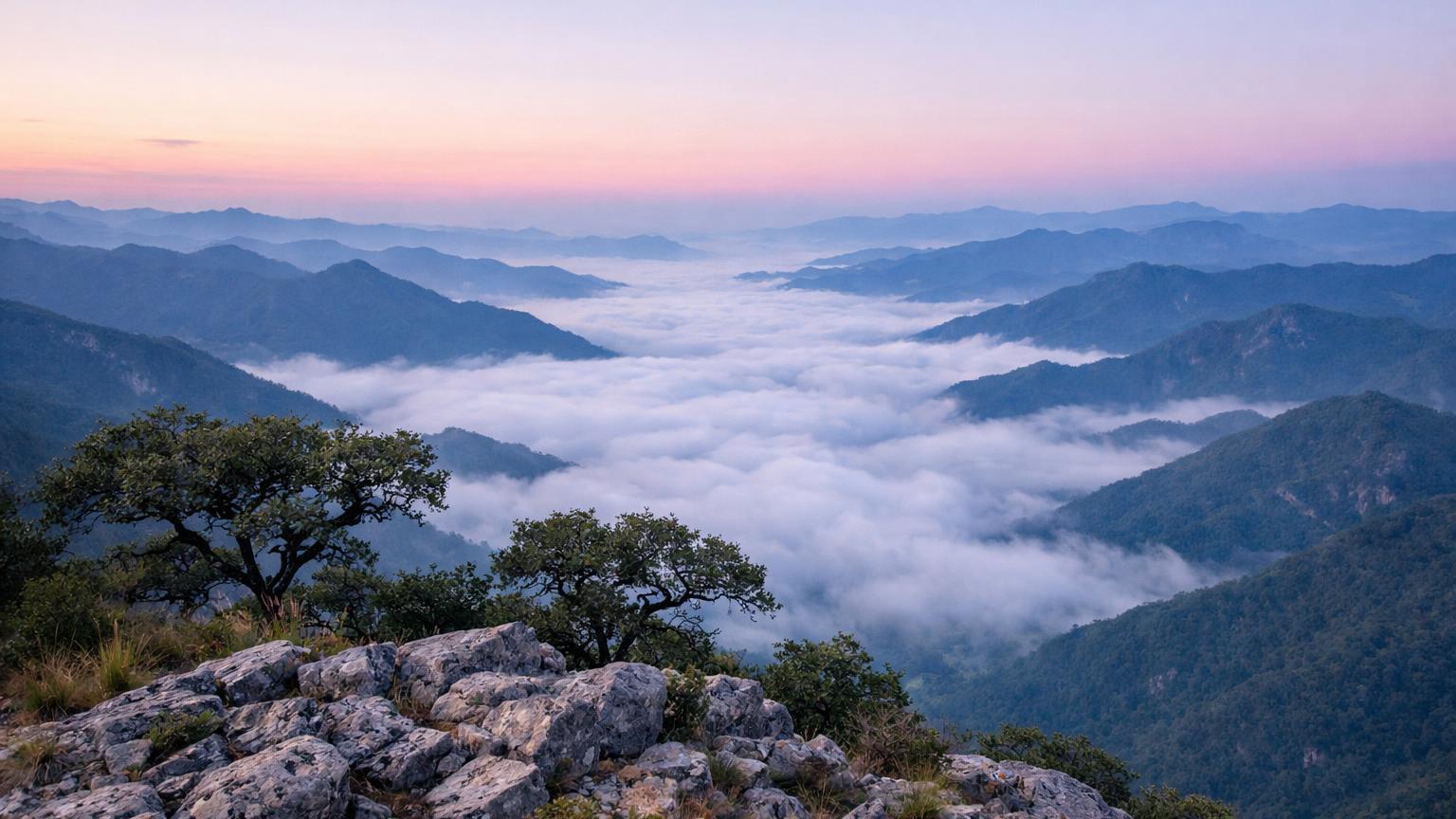
High on a limestone ridge, this viewpoint sits above a quilt of green ranges that peel away toward the Gulf. On still mornings, an inversion pools into a white "sea" and the peaks float like islands. The short dawn hike from the ejido gate makes coffee taste better and photos easier.
The community has improved access and now limits dawn traffic to keep the site calm. Arrive in the blue hour and watch the Sierra change from steel to gold. On clear days you can pick out distant silhouettes—the fun is naming them without checking the map first. Bring a windbreaker; the breeze here bites even in hot months. It’s one of those small-turn, big-reward stops the main highway hides.
Good to know: Access is from Hwy 120; local signs point to Ejido Cuatro Palos. The mirador reopened to visitors on September 18, 2026, after a temporary closure; check locally if another community meeting is scheduled[1]. Entry at the Tejamanil checkpoint is around $30 MXN per person as of 2026, cash only[1]. Best light is sunrise; if you’re not chasing the clouds, late afternoon also works. Insider tip: pack a second set of socks—the grass holds dew past 9 am.
2. Mexico’s tallest year-round waterfall from two rims
Cut into the Candameña Canyon, Basaseachi’s 246-meter drop thunders in the wet months and leaves a lacy veil after long dry spells. Two signed rims give very different looks: the Mirador de la Ventana frames the whole falls with canyon walls, while the lower trail peers up from boulders polished by spray.
The drive from Chihuahua City or Creel turns scenic as pines take over and the air cools. Park roads are paved to the main overlooks; beyond that, trails are rocky but well trodden. Bring layers—shade, altitude, and wind make temperatures swing fast. The detour pairs nicely with Copper Canyon viewpoints if you’re looping the sierra.
Good to know: Open year-round in daylight hours; pay park rights at the official booth. Entry is around $72 MXN per person as of 2026; locals pay less with ID[2]. Summer brings the biggest flow; winter skies are clearer. Shoes with grip help on the switchbacks. Insider tip: visit both rims—sun hits the amphitheater from different angles morning and afternoon.
3. A sandstone "organ" garden you can drive into
Rhyolite towers stand like an orchestra of pipes above rolling scrub, scattered pines, and dirt tracks. Filmmakers love this landscape; drivers do too, because the main circuit enters right among the spires. Short scrambles lead to breezy perches where hawks ride thermals and afternoon light paints the rocks copper.
Sombrerete, a Pueblo Mágico on the old Camino Real, makes an easy base for the park. The road in is signed from Federal 45 and passable for regular cars in dry weather. Camping and basic cabins are available near the entrance; nights are starry and still. Keep your camera handy—every curve reveals a new profile of the "pipes."
Good to know: Day entry is around $50 MXN per adult as of 2026, paid at the gate; ask about camping rates if you plan to stay[3]. Dry season (Nov–Apr) offers the smoothest driving; summer storms can rut side tracks. Sunrise and late afternoon are best for photos. Insider tip: bring binoculars for raptors and scan ledges after thermals build.
4. A jungle road to a Maya giant
From Highway 186 a narrow paved road tunnels through forest for over an hour, then opens onto one of the largest Maya cities anywhere. Calakmul’s temples rise like green-draped pyramids above continuous canopy. Climb the big structures and you can see unbroken jungle to the horizon.
The drive itself is part of the fun: parrots burst from roadside trees, ocellated turkeys strut, and coatis sometimes lope across the asphalt. Facilities are simple but adequate, and staff are helpful about recent conditions. It’s a rare mix of proper road-trip detour and world-class archaeology.
Good to know: Plan on a full day. There are three checkpoints: a first control near Conhuás, and the archaeological gate at km 63. As of 2026, posted costs are around $90 MXN at the first control and $105 MXN nationals / $210 MXN foreigners at the INAH entrance; hours commonly run 8:00–17:00 at the site[4]. Wildlife is most active early and late. Insider tip: top up fuel in Xpujil and carry snacks; services are limited on the spur road.
5. Watch swifts spiral into the earth
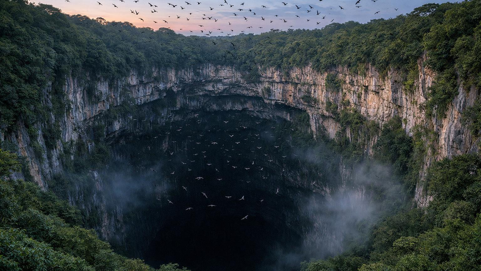
This open-pit cave drops hundreds of meters straight down, its limestone mouth ringed by jungle. At first light, clouds of white-collared swifts and green parakeets rise in spirals and stream into the sky; near dusk they pour back in a reverse vortex. Simple paths and stone steps lead to guard-railed lookouts right at the brink.
The road climbs from the plaza of Aquismón to the community of Unión de Guadalupe; expect tight curves and slow-going vans. Bring a headlamp for early steps and a light jacket even in the tropics—the shade stays cool. The spectacle feels ancient and alive, with bird calls echoing up the shaft.
Good to know: Community access runs roughly from early morning to late afternoon; recent guidance lists 5:00–18:00 for standard visiting, with entry around $100 MXN per person as of 2026, cash at the gate[5]. Rappelling is periodically suspended to protect nesting birds; check locally, as 2026 saw a seasonal pause in spring[6]. Insider tip: arrive 30–40 minutes before sunrise to hear the cave “wake up” before the mass flight.
6. Between two volcanoes on a historic pass
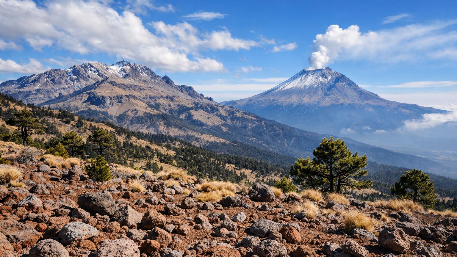
The saddle between Popocatépetl and Iztaccíhuatl tops out near 12,000 feet, with views to the Valley of Mexico on one side and Puebla’s plains on the other. A gravel road continues to La Joya, the hikers’ trailhead below the sleeping "White Woman." On clear days the pass delivers not one vista but a slow panorama as weather rolls through.
Road-trippers park at the visitor area, stretch legs on short trails, and breathe thin, resin-scented air. The driving is straightforward; altitude is not. Take it slow, drink water, and listen for the crackle of ice under boot if a front blew through the night before.
Good to know: To drive beyond the pass to La Joya, you must hold a vehicle reservation with the park; the official visitor page links to the booking portal[7]. Expect to pay about $125 MXN per person for park access as of 2026; policies can change, so confirm before setting out[8]. Mornings are clearest; summer brings afternoon clouds. Insider tip: if you’re sensitive to altitude, spend an hour at Paso de Cortés before heading up to La Joya.
7. Blue-on-blue lakes with two kinds of toll
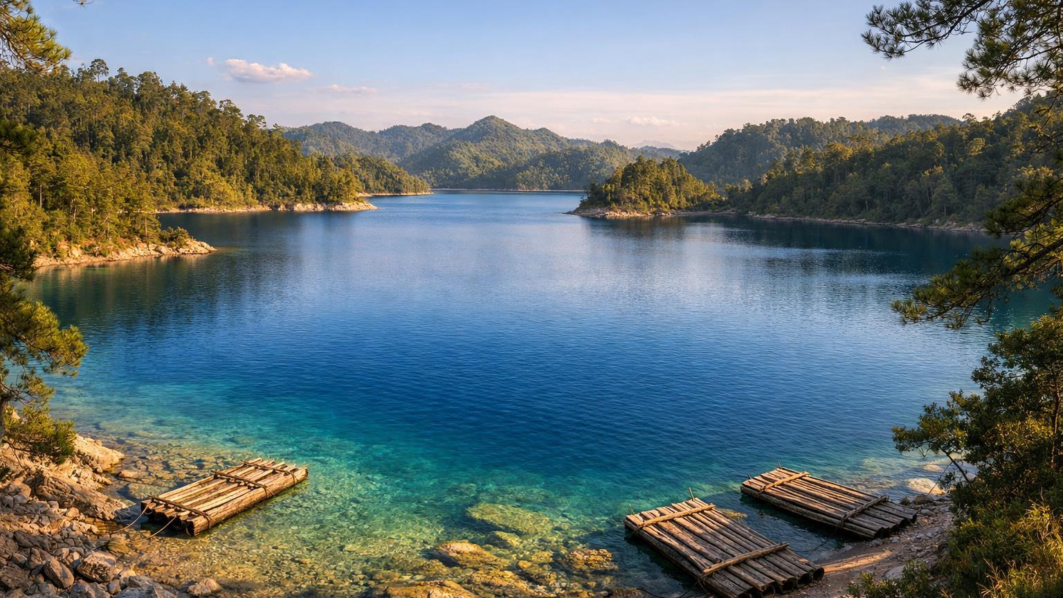
Fifty‑plus karstic lakes scatter south of Comitán, each a different shade of turquoise or jade. A paved loop visits government-administered viewpoints like Bosque Azul and Ensueño, while spur roads reach community-run piers at Cinco Lagos, Pojoj, and the "International" lake that touches Guatemala. The water color changes with sun, clouds, and depth; patience is as useful as a polarizing filter.
It’s a satisfying detour because the driving is easy but the scenes feel far away. Stop for a wooden raft on Pojoj or a slow walk among pines above Bosque Azul. Even busy days spread out over the park’s size, so you can find a quiet turnout for lunch with a view.
Good to know: As of 2026, posted fees are around $65 MXN for nationals/residents and $125 MXN for foreigners at the government-administered access, plus about $40 MXN community fees at lakes like Tziscao, Pojoj, Internacional, Montebello, and Cinco Lagos; bring small bills[9]. Light is best from mid-morning to mid-afternoon when the water glows. Insider tip: rent a simple balsita on Pojoj to reach the tiny orchid island.
8. A waterfall walk that keeps you lingering
Along the Río San Vicente a well-made path strings together a series of falls and bright pools, building to the tall plume of Velo de Novia. The river runs blue-green after clear spells and chocolate after big rains; either way the canyon is handsome, with spray cooling the trail. Benches appear just where you’d want them.
Detouring here breaks up the drive between San Cristóbal and the border route. The road in is paved, parking is straightforward, and the walk suits mixed groups—strong hikers can push higher while relaxed travelers drift from shade to overlook. Reward yourself with a cane-juice or pineapple snack at the end.
Good to know: The park keeps regular hours, 8:00–17:00 daily, with entry around $80 MXN per person as of 2026; zipline and camping cost extra, all paid in cash on-site[10]. Go early for cooler temperatures and softer light. Insider tip: if water levels are high and swimming is paused, enjoy the side lookouts—spray rainbows show up mid-morning on sunny days.
Final thoughts
Detours reward curiosity. These Mexico road trip detours keep the mileage modest and the scenery high, from cloud forests to canyon rims and jungle roads. Fold one or two into your next route and you’ll remember the side trip as clearly as the big destination—proof that the best lines on the map aren’t always the straight ones.
Sources
- Este viernes 18 de septiembre reabre el Mirador Cuatro Palos (tarifa en caseta de Tejamanil) ↩
- Parque Nacional Cascada de Bassaseachic — guía oficial y pago de derechos ↩
- Sombrerete: guía para recorrer el Pueblo Mágico y Sierra de Órganos (tarifas 2026) ↩
- Zona Arqueológica de Calakmul — horarios y costos (turismo Campeche) ↩
- Sótano de las Golondrinas — guía práctica 2026: horarios y precio ↩
- Suspenden descensos por anidación en el Sótano de las Golondrinas (2026) ↩
- CONANP visitante — Iztaccíhuatl-Popocatépetl: reserva vehicular para La Joya ↩
- Popocatépetl e Iztaccíhuatl desde Puebla — información de paso y tarifas 2026 (ADO) ↩
- Parque Nacional Lagunas de Montebello — costos 2026 y cuotas ejidales ↩
- Cascadas El Chiflón — horarios y precios 2026 ↩

